Canada has had no shortage of proposals for new provinces, territories and regions throughout its history.
Washington, D.C.-based geographer Alexandr Trubetskoy imagined what it might look like if many of them came to fruition.
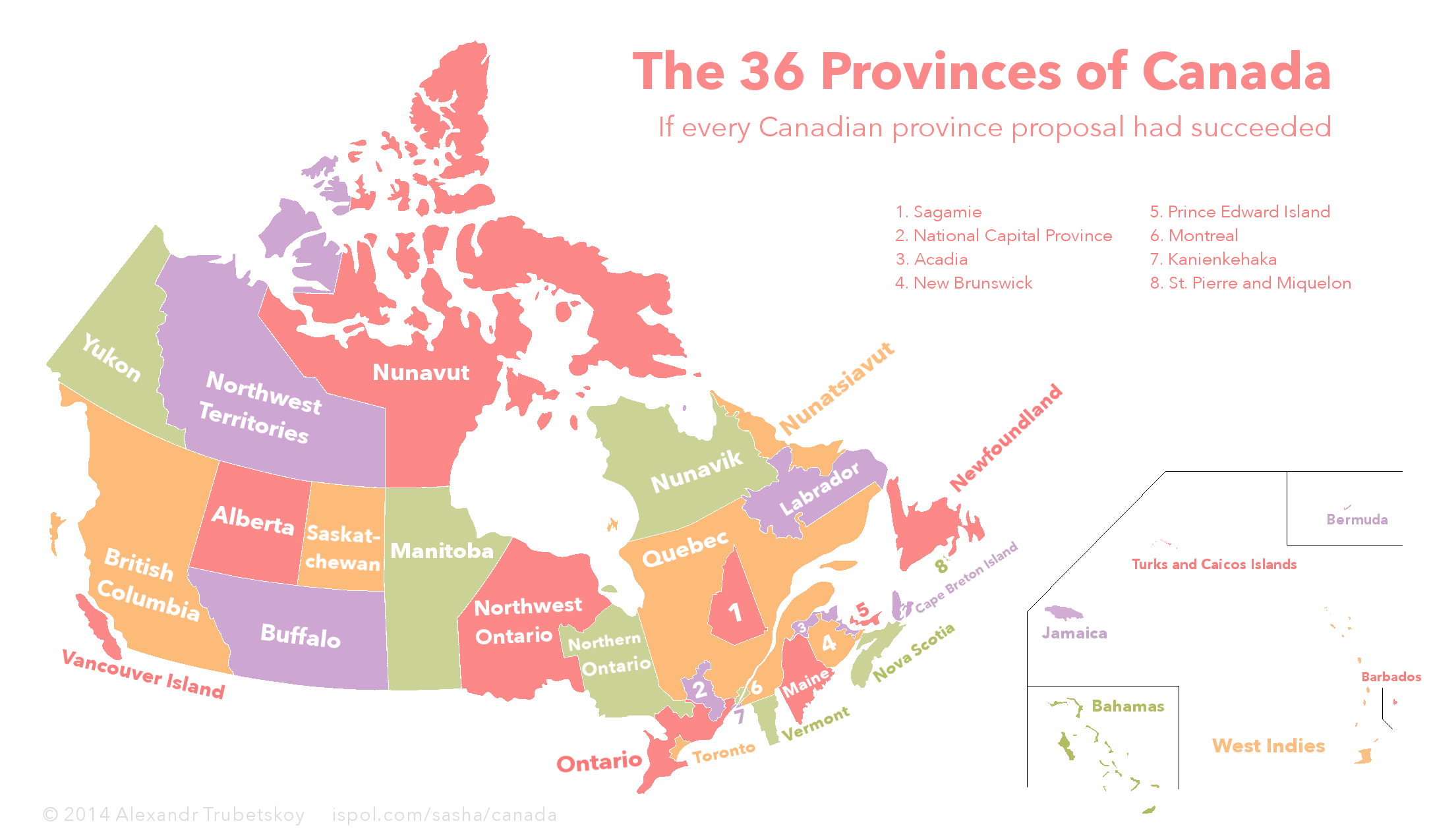
Last week, he posted the following map to Reddit, where it drew plenty of comments.
Explaining the map, Trubetskoy said he included "every new province proposal since the late 19th century that gained any significant political support."
He told The Huffington Post Canada that he was inspired to do the map after looking at a Wikipedia article that listed provinces and territories that have been proposed throughout its history.
And though the list was helpful, he had to do some "historical digging to come up with the most accurate borders for these provinces."
Trubetskoy also had to use different names for brevity's sake. "Sagamie," for example, actually refers to Saguenay-Lac-Saint-Jean, a region in Quebec.
Not all the proposed provinces and territories have had strong support behind them. A movement to see the state of Maine join Canada is largely speculative, while the idea of a National Capital Region was floated as an unrealistic idea in this Ottawa Citizen story.
No comments:
Post a Comment